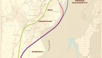
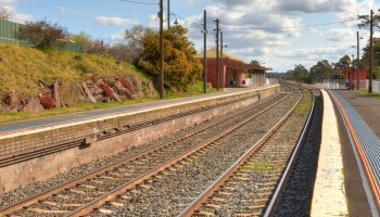
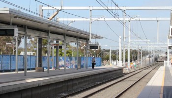
Upper Nepean

Photo by Alan Farlow (Panoramio)

In this 20-kilometre stretch, the line enters a sustained gentle-to-moderate descent from the Southern Highlands down into the Sydney Basin, dropping over 300m in altitude. There aren’t a lot of plausible corridor options here; the Hume Highway already occupies by far the best one, and it is of sufficient straightness and flatness for a high-speed rail alignment.

Continue reading

Yerrinbool

https://en.wikipedia.org/wiki/Yerrinbool,_New_South_Wales

As we get closer to Sydney, the Southern Highlands constricts down to a narrow spit of cleared land nestled between the Blue Mountains on the west and the Upper Nepean gorge on the east, and almost all of the transport infrastructure squeezes into a narrow 500m-wide band between Yerrinbool and Bargo. This limits the room available for deviations but also gives us a choice of several existing corridors to utilise.

Continue reading

Bowral / Mittagong

The geography between Moss Vale and Mittagong presents a significant barrier to infrastructure development, both due to the built up areas of Bowral and Mittagong and also the imposing topography of Mt Gibraltar. For this reason, re-use of the existing corridor is the best and probably only option here.

Continue reading

Moss Vale

Now we are really getting into the heart of the Southern Highlands, with its beautiful rolling pastures, cute hamlets, manicured golf courses, and of course the Shoalhaven Escarpment on the southeastern side. The existing railway between Bundanoon and Moss Vale is pretty windy, so we will need to build a completely new track through moderately difficult terrain.

Continue reading

Wingello to Bundanoon

The existing track between Wingello and Bundanoon winds its way along the northwestern escarpment of the Shoalhaven, making for a dramatic but winding railway. Unfortunately there are only limited opportunities to re-use the existing alignment, so a substantially new alignment will be needed.

Continue reading

Marulan to Wingello

The Marulan sector consists of about half existing alignment and half new alignment around Uringalla. The country is undulating, meaning that significant earthworks and possibly some tunnelling and structures may be required.

Continue reading

Towrang to Marulan

This sector involves some difficult terrain, with the Wollondilly River winding between hilly country. The eastern part of the alignment approaching Marulan is unproblematic; curves are minimal and there is even a former trackbed on the north side of the tracks that can be reutilised for most of the length.

Continue reading

Goulburn East

The existing alignment out of Goulburn has a minimum radius of 600m, yet it should be possible to increase to 1000m or possibly 1500m with only small modifications to the existing corridor. Geography, other transport corridors and existing development impose substantial constraints beyond this; any faster deviation will be very expensive and should therefore be deferred until higher-speed operations are required.

Continue reading

Bungendore to Mt Fairy

North of Bungendore, the line encounters rolling countryside with a few substantial hills that must ideally be avoided. There are fewer sections of the existing alignment with minimum radius under 1000m (the smallest radius at which 200km/h is possible with tilting trains). We are therefore able to use the existing…

Continue reading

Goulburn approach

The final sector on the Canberra Line is the run into Goulburn, a major regional centre for which access is a priority. The existing line diverges from the Main Southern Line just south of the city, however existing radii are tight at approximately 240m. There are several options for high-speed entry…

Continue reading